Sunday, October 16, 2011

Chapter 9

The Changing South

The subtropical climate and good soils formed many fertile areas for agriculture in Louisiana. Cotton production dominated the South as early as the 1830s. Cotton was profitable for plantation owners because of the large-scale cultivation using slave labor. The cotton boom increased the demand for slaves by the 1850s and by that time, slaves made up 50 percent of the population in the four large cotton producing states, Louisiana, Alabama, Georgia and Mississippi.


The Cajuns in Louisiana are French-speaking Catholics from Nova Scotia and New Brunswick (formerly Acadia). They were forced to leave by the non-Catholic British who took the region from the French in 1763. The Cajuns remained in Louisiana after Jefferson purchased it in 1803 and are now a distinctive part of the South’s culture.  


As of 2000, Catholics were mainly distributed in the southern part of Louisiana and Baptists in the northern part.

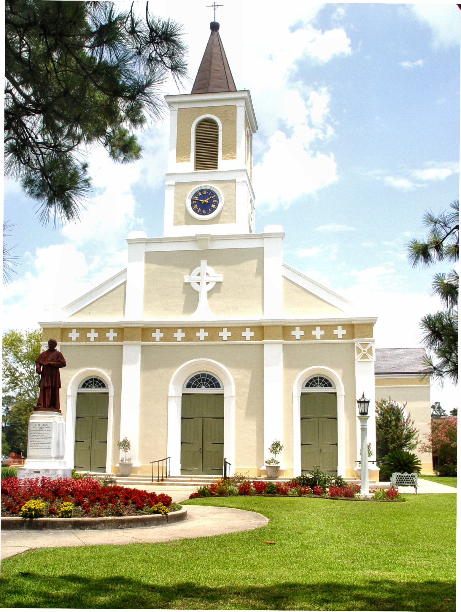
Church in New Orleans

The Southern economy suffered after the Civil War ended in 1865 but cotton continued to dominate as well as tobacco production. By 1880, the economy entered the manufacturing stage. Textile manufacturing was relocated to the South, and Railroad reconstruction, Cigarette, Timber, iron and steel manufacturing helped improve the economy. Segregation followed the Civil War and Outmigration was the result of racial oppression and poverty in the South.


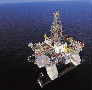
Today, farming is less important to Louisiana's economy. Petroleum and coal manufacturing and chemical manufacturing are major contributors to the economy. Service opportunities in tourism, retail, and government have also increased. New Orleans remains a major cultural location in the United States. Cajun and Creole cuisine is also a major highlight of Louisiana.

Beignets

Cajun Shrimp


Resources:
Birdsall, Palka, Malinowski, Price. Regional Landscapes of The United States & Canada.
http://www.history.iastate.edu/agprimer/Page28.html
http://www.valpo.edu/geomet/geo/courses/geo200/religion.html
http://www.britannica.com/EBchecked/topic/349271/Louisiana

Photos:
https://blogger.googleusercontent.com/img/b/R29vZ2xl/AVvXsEiUHkQBy0AB6okiMJCl8P7_rMdDI6JI82xpo7tvSP5GJI4VlirbGlAQKVSBhlV4bXlIDip143Ndl149DvFcNSkcX6hyR3LKBXarN-PcmKSX52ziF4xtBTeWNBRm6A00zIHTSHxYkfKP3oAW/s1600/800px-CottonPlant.jpg

http://www.doa.louisiana.gov/census/theme/cajun.jpg
http://www.neworleanschurches.com/mdetours_laf/detours2.jpg
http://www.wbrz.com/images/news/timber.JPG
http://farm4.static.flickr.com/3038/2834792794_90712d6433.jpg
http://steamykitchen.com/wp-content/uploads/2010/03/killer-cajun-shirmp1.jpg

Chapter 8

Appalachia and the Ozarks are one the most extensive mountainous region unlike the mostly flat Louisiana.  The tallest mountain in Louisiana is Driskill at a mere 535 feet in comparison to the tallest Appalachian mountain that reaches 6,684 feet in the air (Mt. Mitchell).

 This photo illustrates the height of the tallest mountain (or hill) in Louisiana.


Resources:
http://www.peakbagger.com/peak.aspx?pid=6630

http://www.peakbagger.com/range.aspx?rid=16
Photo:

Chapter 7

The Bypassed East includes New York, Vermont, New Hampshire, New Brunswick, Nova Scotia and Newfoundland. While Louisiana is not part of the Bypassed East, both regions are well known for fishing.


Photo:

Chapter 5

The North American Manufacturing Core
 
Louisiana is not located within the Manufacturing Core but its industrial concentration includes petroleum and coal, chemicals and paper. 

 Transocean Horizon Oil Rig

Louisiana is the nation’s third largest producer of petroleum and the second largest producer of natural gas. It is also the second largest sugar cane and sweet potato production in America. Louisiana produces 25% of the nation’s petrochemicals and 25% of all the seafood in America. More shrimp is caught in Louisiana than any other place in America.
                           
Crawfish Boil 


Resources:
Photos:


Chapter 4

Megalopolis

New Orleans is the largest populated city in Louisiana, 343,829 people live in New Orleans. Since it occupies a coastal position and it has accessible harbors, it has megalopolis similarities. The Louisiana population has been and still is mostly urban.

Year
Rural
Urban
Total Population
    1980
1,117,072
3,089,044
4,206,116
    1990
1,091,103
3,128,870
4,219,973
    2000
1,128,309
3,340,667
4,468,976
    2010
1,152,634
3,380,738
4,533,372

Data updated September 14, 2011 


Louisiana has a vast system of navigable waterways. The port of New Orleans is amongst the busiest ports in the country in seaborne freight, while Baton Rouge is important for shipping petroleum and chemical products. Railroads became common after the 1830s and there are nearly 3,000 miles of tracks still used in Louisiana. Several miles of highways and dozens of airports add to Louisiana’s transportation means.


Resources:
Photo: 
http://besthotelso.com/images/category/new-orelans-1310128400.jpg
http://www.discoverneworleans.com/maps/louisiana.gif

Saturday, October 15, 2011

Chapter 3

Foundations of Human Activity

The first European settlement was in 1702 by France. Pierre Le Moyne d’Iberville and his brother Jean-Baptiste Le Moyne d’Iberville  found permanent settlements in Louisiana. In 1714, Louis Juchereau de St. Denis established Natchitoches and his brother, Sieur de Bienville, established New Orleans four years later. French culture was firmly planted here even though Louisiana did not thrive economically during 1712 to 1731. In 1762, France ceded Louisiana to Spain and Spaniards, Canary Islanders, Acadian refugees from Nova Scotia added to the population. In 1800, Napoleon forced the Spanish government to return Louisiana to France, but in 1803 he sold it to the US.

According to the 2010 Census Bureau, the population in Louisiana is made up of 49% males and 51% females. 64% of the population is white (French, Spanish, English, Irish, Scottish or German descent) and 33% of the population is black. The remaining races are Asian, American Indian or some other race.
 

Sportsman's Paradise is made up of rivers, lakes, dense forests, rolling hills and an abundant wildlife. This area offers bird-watching, deer and quail hunting and record-breaking trout fishing. 

Crossroads is located in the center of Louisiana and this region allows recreational activities such as water sports, fishing, hunting, and camping. The largest cities in this region are: Natchitoches (oldest city in Louisiana), Alexandria and Leesville.

Cajun Country was settled by French Canadians and their culture is known for spicy food, Zydeco (folk) music and their dialect (Patois). This is the place to attend a crawfish boil, tour the TABASCO hot sauce factory or take a Cajun swamp tour. Lake Charles, Lafayette and Avery Island are the largest cities in this region.

Plantation Country is home to Baton Rouge and the majority of Louisiana's plantations are located here. It is also well-known for rustic churches, art galleries, and museums.

Houmas House Plantation
Greater New Orleans offers beautiful architecture, galleries, shopping, first-class cuisine, nightclubs and streetcar and riverboat rides.

After Hurricanes Katrina, Wilma and Rita in 2005, the “population decreased from about 4,068,028 from January through August 2005 to about 3,688,996 from September through December 2005, the Bureau estimates.” (Rosenberg).


“At least 1,836 people lost their lives in Hurricane Katrina and in the subsequent floods, making it the deadliest U.S. hurricane since the 1928 Okeechobee Hurricane. Damages are estimated at $81.2 billion, making it the costliest natural disaster in U.S. history.” **


Resources retrieved from: 
**http://awesomeamerica.com/louisiana/
Photos:

Chapter 2

The Physical Environment

Louisiana is one of the lowest and flattest areas in the United States with an average elevation of 100 ft above sea level. Many Bayous are in the south and Lake Pontchartrain is the state’s largest natural salty lake. About half of the state is forested with cypress, oak, water tupelo, willow, cottonwood, and pines. The swamps in the south support the bald cypress and plants like ferns, vines and water hyacinth. Saltwater, freshwater and brackish marshes are found along the Gulf coast.

Louisiana can be divided into three geographic areas of land. 

The East Gulf Coastal Plain lies to the east of the Mississippi River north of Lake Pontchartrain. The land is low, consists of marshland near the river and rises slightly in the north to rolling hills.

The Mississippi Alluvial Plain stretches along the Mississippi River from Arkansas in the north to the Gulf of Mexico in the south. Along the river, there are fields atop the ridge called ‘frontlands’ and the land that slopes away from here, comprises of clay and silt and referred to as the ‘backlands.’ The Mississippi Delta, at the mouth of the Mississippi River covers about 13,000 square miles (about 1/4 of Louisiana) and consists of silt deposited by the river. It is the most fertile area of Louisiana.

The West Gulf Coastal Plain lies west of the Mississippi Alluvial Plain. Towards Arkansas, the land gradually rises and about 40 miles from the Arkansas state line is the highest point in Louisiana, Driskill Mountain (535 ft). Gently rolling landscape are north of the marshlands (Louisiana Prairies) and along the gulf, behind the barrier beaches are marshes that extend 20 miles north into Louisiana.


Climate
Louisiana has a subtropical climate. 
Summers are hot and humid and winters are mild to cool.

July temperatures average from 81° to 83° F.
January temperatures average from 53º F in the south to 47º Fin the north.

Highest temperature: 114 degrees 8/10/1936
Lowest temperature: -16 degrees 2/13/1899


Prism Climate Group. Average Annual Precipitation, 1971-2000 Louisiana.

Chapter 1

Regions and Themes
 
Louisiana is bordered by Arkansas on the north, the Gulf of Mexico on the south, Mississippi on the east and Texas on the West. About 15% of Louisiana is covered by water and the remaining 85% is land. The highest point is Driskill Mountain at 535 ft above sea level and the lowest point is 8 ft below sea level in New Orleans. 


Louisiana has 64 parishes (counties) in a grid like formation where 104 persons per square mile live. Louisiana has three ferry crossings that have been in operation since 1969 and they have been an important part of the New Orleans urban mass transit system. Since 1988 the Greater New Orleans Bridge #1 and #2 has been in continuous operation.  

Louisiana’s 64 parishes


The top three manufacturing activities are the production of chemicals, Petroleum and coal processing and paper production. The agricultural income is split between crops and livestock. 60% is generated from crops (sugar cane is the leading crop) and 40% is generated from livestock (mostly cattle and calves). 90% of the state’s mining income is generated from petroleum and natural gas. Louisiana is one of the leading states in commercial fishing and the leading state in shrimp production.          

The Geismar chemicals manufacturing complex in Louisiana


 According to the 2010 U.S. Census Bureau; Louisiana’s population increased to 4,533,372 from 4,468,976 in 2000. The home-ownership rate is 68.2% and the median value of owner-occupied housing units: $121,300 (2005 to 2009). Per capita money income in 2009: $22,535. The median household income in 2009 is $42,460 and persons below the poverty level: 17.6% (14.3% nation).


The original Indian inhabitants, plus the descendants of French, Spanish, English, German, Acadians, West Indians, Africans, Irish, and Italians are a part of Louisiana’s rich diversity of people.


Resources retrieved from:
Louisiana
The Geography of Louisiana
U.S. Census Bureau Delivers Louisiana's 2010 Census Population Totals

Photo credits:
Map of Parishes by Brad Cole: http://geology.com/state-map/louisiana.shtml 
Mfg plant photo courtesy of Shell Chemicals Ltd: http://www.chemicals-technology.com/projects/ptt/ptt1.html